Exhibition
Immerse yourself in the lives of Gladstone Region locals....
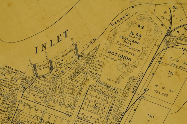
Maps
This exhibition includes detailed copies of Admiralty maps and drawings depicting the coast line of the East Coast of Australia and Port Curtis (Gladstone) from 1799. Also on display are surveyors’ street and locality maps of the Gladstone Regional Council area from 1853.
In collaboration with this exhibition an exciting public program has been organised: Maps & Music. Camerata - Queensland’s Chamber Orchestra will present a performance in response to the displayed Maps.
Performing without a conductor, Camerata’s players have established a reputation for passionate, exciting performances that engage audiences of all ages.
This performance is made possible with the generous support of the Tim Fairfax Family Foundation and the Queensland Government through Arts Queensland.
Maps & Music
Light refreshments provided
RSVP by 5pm, Friday, 21 June 2019, by phoning 4976 6766 or emailing gragm@gladstone.qld.gov.au